The Vast Diversity of the Asian Continent
Asia covers nearly 30% of Earth's total land area and is home to over 4.7 billion people. From the Siberian tundra in the north to the tropical islands of Indonesia in the south, the geographic diversity is unparalleled. Using a map of Asia with countries is essential for understanding how these 48 sovereign nations interact economically and politically. In 2026, Asia remains the primary engine of global growth, making accurate mapping tools more important than ever for business and education alike.
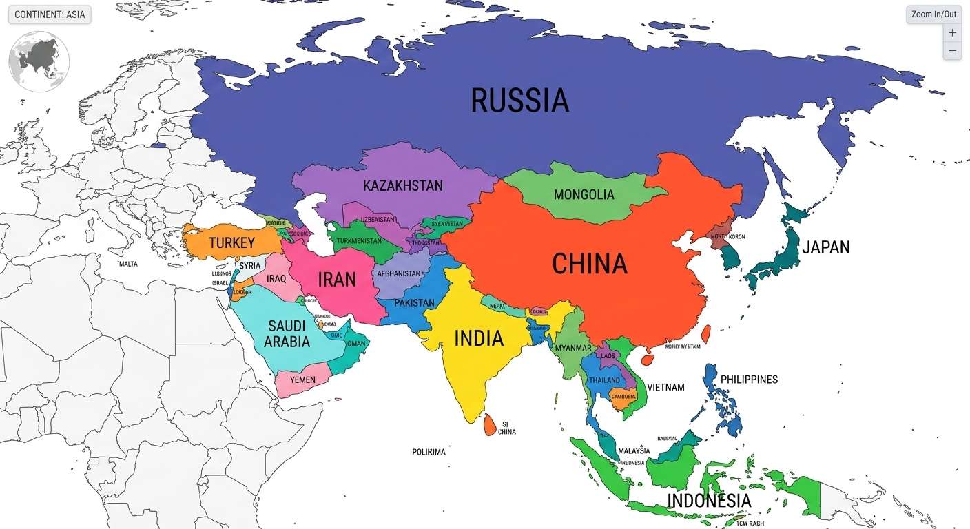
Defining the Five Major Sub-Regions
To make sense of such a large area, geographers typically divide the continent into five distinct sub-regions, all of which can be individually highlighted using our map editor:
- East Asia: Including China, Japan, South Korea, and Mongolia. This region is a global hub for technology and finance.
- South Asia: Dominated by the Indian subcontinent, including Pakistan, Bangladesh, and Sri Lanka.
- Southeast Asia: A mix of mainland nations and archipelagos like Vietnam, Thailand, and the Philippines.
- Central Asia: The landlocked "Stans," such as Kazakhstan and Uzbekistan, historical centers of the Silk Road.
- Western Asia: Often referred to as the Middle East, including Turkey, Saudi Arabia, and the Levant.
Classroom Idea: Use the "Color Bucket" tool to identify the different time zones across Asia. It is a fantastic way to visualize why Beijing and Istanbul have such different daily rhythms despite being on the same continent.
Educational Applications: Blank Asia Maps
For educators, a blank Asia map is one of the most versatile tools available. Because Asia contains both the highest point (Mount Everest) and the lowest point (The Dead Sea) on Earth, it serves as the perfect case study for physical geography. Students can use WorldMap Pro to mark mountain ranges, major river systems like the Ganges and Yangtze, and expanding urban corridors.
Privacy-Safe Learning
Following the standards seen in our other educational guides, WorldMap Pro ensures that students can explore the Asia map with countries without ever needing to provide personal data. All edits stay local, keeping the focus on learning rather than account management.
Create Your Custom Asia Map
Highlight regions, add pins, and export high-resolution visuals for free.
Open Map Tool →