A Continent of Science and Peace
Unlike the other six continents, Antarctica is governed by the Antarctic Treaty System, which sets it aside as a scientific preserve and bans military activity. When you look at an Antarctica map, you won't see traditional country borders. Instead, you'll see territory claims and the locations of over 70 scientific research stations operated by dozens of different nations.
The Physical Extremes
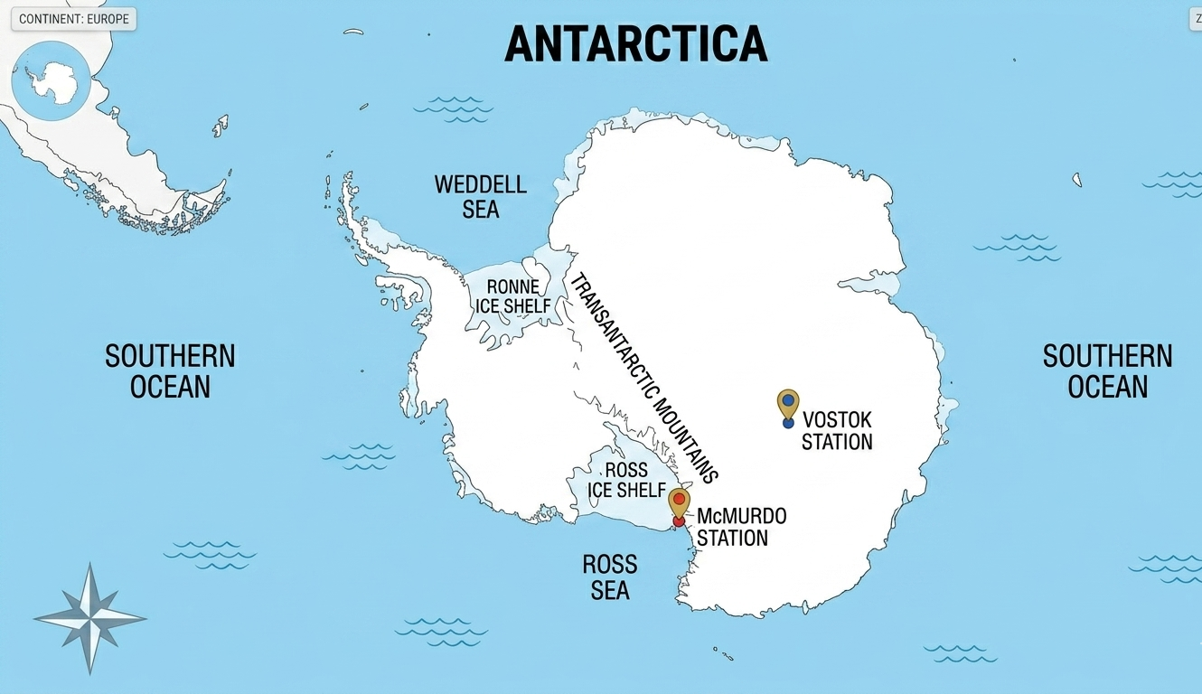
Antarctica is the coldest, driest, and windiest continent on Earth. It contains 90% of all the ice on the planet and between 60% and 70% of the world's fresh water. Using WorldMap Pro, you can visualize the Transantarctic Mountains, which divide the continent into East and West, and the massive ice shelves like the Ross and Ronne shelves that extend into the Southern Ocean.
Map Fact: Because all lines of longitude converge at the South Pole, Antarctica technically sits in every time zone simultaneously! Research stations usually adopt the time of their home country or their supply hub.
Using the Map for Climate Education
In 2026, tracking the changes in the Antarctic ice sheet is vital for understanding global sea-level rise. Educators use our interactive map tool to mark the locations of key research hubs like McMurdo Station (USA) and Vostok Station (Russia). By adding pins and notes to these locations, students can learn about the groundbreaking research being conducted in sub-zero temperatures.
Customizing Your Arctic View
Because Antarctica is often distorted on standard rectangular maps, our tool offers a dedicated polar view. This perspective allows you to accurately measure distances between the coast and the South Pole, providing a much more realistic sense of the continent's massive 5.5 million square mile area.
Explore the Frozen Continent
Start your polar mapping project today. High-resolution, privacy-safe, and free.
Open Map Tool →