Understanding the True Scale of Africa
One of the greatest misconceptions in geography is the relative size of Africa compared to other continents. Due to map projections like Mercator, Africa often appears smaller than it actually is. In reality, Africa is large enough to encompass the United States, China, India, and most of Europe within its borders. Using an interactive Africa map allows users to see the continent without traditional distortion, offering a more respectful and accurate perspective of its vastness.
Did you know? Africa is the only continent that spans all four hemispheres: northern, southern, eastern, and western. This makes it a perfect subject for global geography lessons.
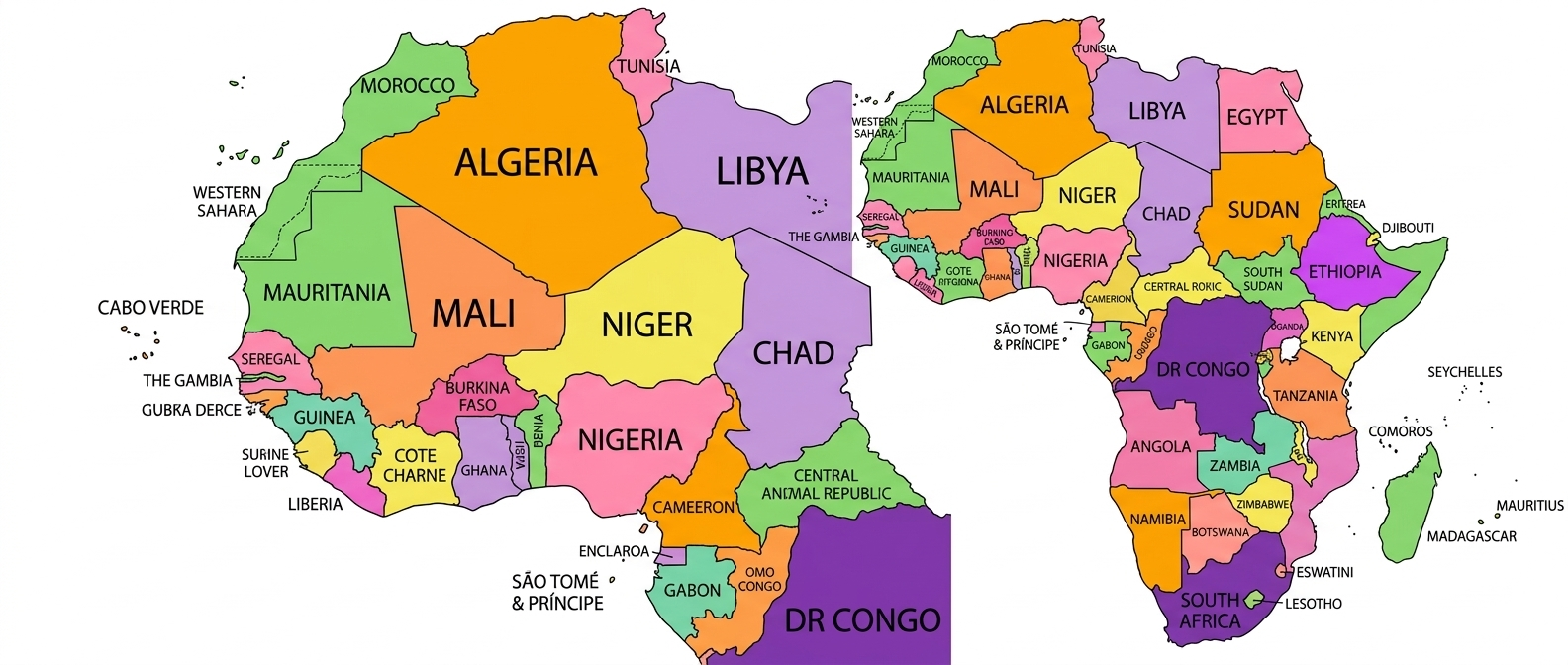
The Five Key Regions of Africa
To simplify the complexity of 54 nations, our Africa map with countries allows you to categorize the continent into five major regions based on geographic and cultural factors:
- North Africa: Nations bordering the Mediterranean, including Egypt, Morocco, and Algeria.
- West Africa: Home to economic giants like Nigeria, Ghana, and Senegal.
- East Africa: The land of the Great Rift Valley, Mount Kilimanjaro, and Kenya.
- Central Africa: Dominated by the Congo Basin and its massive tropical rainforests.
- Southern Africa: Stretching from the Kalahari Desert to the urban centers of South Africa.
Modern Use Cases: From Resources to Trade
In 2026, Africa is at the center of the global green energy transition. Researchers use WorldMap Pro to mark the "Lithium Triangle" and the diverse mineral resources found across the continent. Because our tool does not require an account, researchers can quickly create visuals without worrying about data harvesting.
Visualizing the AfCFTA
The African Continental Free Trade Area (AfCFTA) is the world's largest free trade area. Business analysts use our interactive map tool to highlight member states and visualize trade corridors that are transforming continental commerce. By identifying key border crossings and logistics hubs, businesses can better navigate the African market.
Educational Value: Blank Africa Maps
Geography is more than just memorization—it's about understanding connections. Teachers use our tool to generate blank Africa maps for quizzes. Students can color-code nations based on official languages, colonial history, or natural resources. This active learning approach helps students understand why certain regions develop differently based on their geography.
Build Your Own Africa Map
Start your data visualization project today with our free, privacy-safe tools. No data leaves your browser.
Open Map Tool →